There are different technological tools by which one can determine location of living beings, species or ecosystems or natural habitats on the Earth. The locations can be depicted in the form of map in reference to spatial attributes like geographical distribution, natural organization, ecological setup and structure of the landscape and / or temporal attributes like time or seasons or duration. Conceptualization and generation of maps based on spatial and temporal attributes of a species or community or ecosystems is called Ecological Mapping or Eco Mapping. Ecological mapping represents the natural organization of a landscape. It offers suitable resolutions, based upon a regionalized process, and provides an ecological basis for planning activities that may impact upon the environment.
A layman can do Eco-Mapping in own area using two basic tools & techniques – ‘Global Positioning System (GPS)’ and ‘Google Earth Pro’.
I. Global Positioning System (GPS)
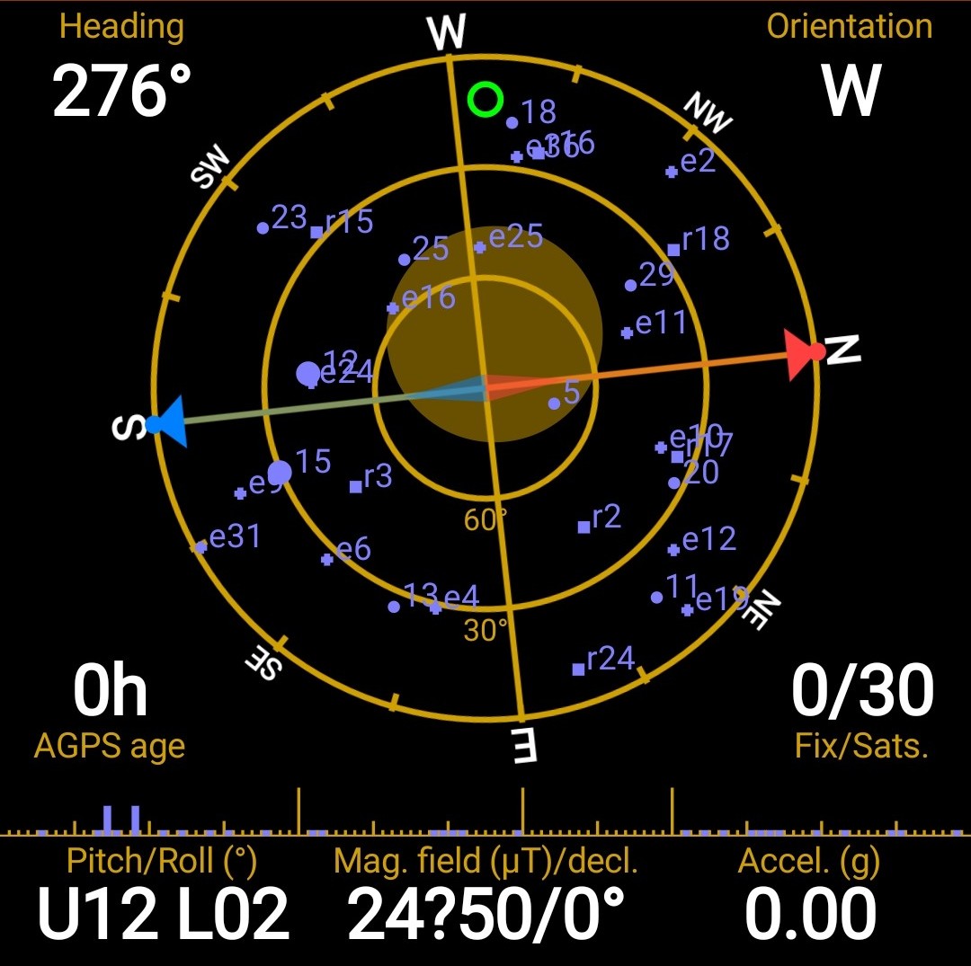
The Global Positioning System is a space-based radio navigation system. It is comprised of three parts – The space segment, the control segment and the user segment. The space segment is composed of more than 30 operational satellites distributed in six orbital planes inclined 55° from the equator at 20,200 km above the earth's surface and circling the Earth every 12 hours. The control segment is the station on the Earth that is maintaining and monitoring the GPS satellites. The user segment is the receiver (device) that receives and processes navigation signals from the GPS satellites and calculates position and time.
The GPS satellites can pinpoint a three dimensional position to meter-level accuracy. To pinpoint the 3D location of any receiver on the Earth at least four satellites are available at a time anywhere in the world. The GPS system has wide range of applications in different fields like agriculture, biology, geology, marine, ecology, navigational, military, war, land use, natural resource management, tracking of movements and social applications and many more.
II. Google Earth Pro
Google Earth Pro is a computer program that displays the entire world on a computer screen in 3D using satellite imagery. Users can view different features on Google Earth from various angles by layering satellite images, aerial photographs, and additional information like roads, railways, cities, and landmarks onto a 3D model of the Earth. This application is helpful for locating geographical positions (latitude and longitude), obtaining directions from one place to another, creating maps with high-resolution satellite images, marking and saving routes, landmarks, and features, as well as analyzing land use and cover.
Scientists and others use specialized devices called GPS handheld instruments for precise navigation in important national and international operations. However, advancements in technology have made GPS applications accessible to the public too. Nowadays, GPS applications are available on mobile devices, allowing people to easily determine their location or navigate for various purposes using a GPS satellite signal receiver device. Similarly, Google Earth is also accessible on desktop and mobile devices and serves the purposes of mapping.
Both GPS and Google Earth Pro applications are user-friendly tools for eco-mapping that can be utilized by ordinary individuals. They enable the creation of various digital records associated with specific locations and times for diverse purposes.